On a grey evening last autumn in the outer concourse of drab Euston Station, I took pity on two teachers and their assistants who were corralling a large group of school-children. I offered them a distraction. We moved across to one of the two statues – not that of railway hero, Robert Stephenson. The throng scattered at our approach, including those perched on the plinth, eating their sandwiches with their backs to the main figure thereon. His cat certainly gets more attention, evidenced by the increased polish of his head. ‘Now, this man is Captain Matthew Flinders. Can anyone tell me anything about him?’ Silence.
I was present some ten years earlier when the bicentenary of Flinders’ death was marked by the unveiling of the statue by Prince William, not here, but amidst an enthusiastic gathering in the grand atrium of a High Commission on the Strand. Here there was no doubt about the status of this man. For them his memory was kept alive in the name of a town, a university, a railway station, not to mention three islands, a bay, a river and a mountain range. His reputation and memory had launched the creation of one of the world’s major museums. That great Dominion had furnished most of his biographers. Everyone here would have one prominent thought. This was the man whose famous chart of the continent established its name, ‘Australia’.
One place in England where Matthew Flinders is unquestionably a hero is Donington in Lincolnshire, where he was born in 1774 and grew up in the comfortable home of the town’s general practitioner. Unable to persuade this eldest son to follow quietly in his footsteps, Dr Flinders used family links to secure the patronage of a Royal Naval captain with whom Matthew would serve in Bellerophon in the first great battle of the French Revolutionary War, the ‘Glorious First of June’. Matthew had already, however, found the inspiration, formed the aspiration, and, perhaps, developed the self-confidence – and obstinate determination – that are necessary for the emergence of a hero.
With characteristic application, he had demonstrated a grasp of the latest navigational techniques, especially the management of chronometers. This had earned him a place on William Bligh’s second, successful breadfruit voyage in 1791. He was destined not to look back but to earn a place alongside Bligh and Cook in a galaxy labelled by the National Maritime Museum as ‘Pioneers of the Pacific’. His achievement, however, has not gone unquestioned, both at the time and now. He illustrates all the questions surrounding the definition of a hero. For whom, and when – in lifetime or after death? Flinders himself carried question marks throughout his work, conscious of following in big footsteps of heroes of his own time.
Flinders had understudied Bligh closely and built up his skills, submitting a chart of the Torres Strait as part of the new navigational information arising from the voyage. Now a fellow officer in Bellerophon alerted him to a fresh opportunity to continue such work. He secured a place in the ship carrying a new governor to New South Wales. A companion onboard was another Lincolnshire man, the surgeon George Bass. They would make significant advances in the hydrographic examination of the continent, of which only two segments of coastline were represented on existing charts. ‘New Holland’ was the label for the western coasts visited principally by Dutch voyagers. ‘New South Wales’ was the name given to the portion of the eastern seaboard traversed by James Cook on his first voyage. Big questions remained unanswered. Was New South Wales connected to Van Dieman’s Land, another coast first sighted by the Dutch? It was Bass and Flinders, working in tiny craft, who established the existence of the strait which bears the former’s name, and Flinders who urged its strategic significance as a potential route for ships in the China trade.
When Flinders returned to England in 1800, his insights and reports of further examination of the coast of New South Wales soon commended him to the immensely influential Sir Joseph Banks. Attention was also focussed on the Antipodes by awareness that the French government was fitting out a scientific expedition to be despatched to the area. The stakes were high. Whilst both governments might declare their goal as the pursuit of science, and issue passports to counterparts, they were aware that the permanent presence that Britain had achieved in Port Jackson conveyed strategic wartime advantage. British preparations were now more rushed than those in France, where two ships were fitted out and a large specialist team assembled. In London the Admiralty ordered the fitting out of just one vessel, a former collier, the ship type proved ideal for hydrographic work during Cook’s voyages. She was named Investigator. Matthew Flinders was appointed in command.
Flinders made landfall at Cape Leeuwin, the south-western extremity of the continent on 4 November 1801. By his orders from the Admiralty he should now have proceeded to Port Jackson to refit and make ready for survey. Instead he immediately commenced the examination of the coast. It seems probable that he was aware that his competitors, as he saw them, were already in theatre. There was that major question to resolve. Were New Holland and New South Wales separated by sea extending from the Gulf of Carpentaria to an outlet here in the south? The man who established the truth would command fame as well as delivering benefit to his country.
After making repairs in King George’s Sound, which had been charted by Captain George Vancouver during his passage to the North East Pacific, Flinders pressed on to the unknown coast. With infinite care to ensure that every segment was sighted and laid down on his track chart, he entered gulfs and disproved any connection with a middle sea. It was now that he met his French counterpart Nicholas Baudin, who was working his way westward along the coast. Both men would resort to Port Jackson to refit their ships. Here Flinders could take stock of the information gathered by the two expeditions, and by other Royal Naval parties on the coast.
In July 1802 he set off again to undertake the same meticulous work, this time progressing northwards. Flinders was deeply conscious that he was now on a coast where his hero James Cook had worked. Though he had the advantage of carrying chronometers, which Cook did not have on his first voyage, Flinders would agonise over every difference between his own results and those of Cook. His application would be rewarded by successful passage through the Great Barrier Reef and an astonishingly swift transit of the Torres Strait. Back in 1792 it had taken Bligh 19 days to find a way through. Flinders achieved it with only three actual sailing days.
He now began a major element of the Admiralty Instructions, a detailed examination of the Gulf of Carpentaria. The resulting charts would serve mariners until fresh surveys in the mid-twentieth century. The time on this coast would confirm another aspect of Flinders’ voyage. The warm and fruitful relationship which he established with Pobassoo, chief of the Malaccan trepang divers, was consistent with his judicious contact with first nations. Whilst Cook’s voyages have been subject to intensive revisionist study, Flinders has avoided criticism.
The work in the Gulf of Carpentaria revealed alarming deterioration of the condition of Investigator. Flinders set off for the port of Coupang on the island of Timor, where his hope of finding a ship bound for Europe which could carry an appeal to the Admiralty for a new hull was dashed. He now completed his circumnavigation, the first known circumnavigation of the continent, carrying out some investigations on the coast of New Holland before return to Port Jackson. The first ship that he now selected in which to make a return to England was wrecked on an unknown reef in the eastern approaches to the Torres Strait The second was a tiny vessel quite inadequate for such a voyage. Forced to call at Mauritius for repairs, he discovered that war with France had resumed. He would be detained there for six and a half years. His work was unfinished. He was only 30 years old.
When he finally came home in 1810, he was promoted post captain, but otherwise received muted attention and limited support. Seven years of combat with Napoleon Bonaparte had hardened hearts. Even Sir Joseph Banks had come to recognise that the mutual courtesies of the world of science had been swept away. Other hydrographic practitioners were submitting frontline survey work from three major maritime campaigns which had been in progress since 1809. Even Captain Thomas Hurd, the Hydrographer, whose personal experience might have made him sympathetic, may have wondered at Flinders’ insistence on receiving formal French rescindment of the parole which precluded him from further war service. So, Flinders made appearances at Sheerness and Portsmouth to apply the lessons he had learnt in seeking to reduce the impact of compass deviation – a contribution ultimately commemorated in the Flinders Bar fitted to all magnetic compass binnacles. But otherwise his final years, culminating in a lost struggle with illness, were devoted to bringing his work to publication.
It is here that Flinders has my vote as a historical hero. I have conducted a detailed study of his survey methodology and of the work that resulted. Over eighty manuscript sheets survive in the British archives, an unmatched output from any contemporary surveyor. Alongside them are his journals and the Bearing Book in which he registered the framework of his meticulous running survey. Whilst Mr John Aken, the ship’s master, was a great help to him, he missed the skills of John Crosley the astronomer, who had fallen sick on the outbound voyage. Some of the charts in the archives are salt-stained survivals from his shipwreck. Others are sheets that he worked on in Mauritius, replotting lost work. A huge blow was the revelation in 1811 of errors in the editions of the Nautical Almanac that had been used during the voyage. More than half of his work had to be rechecked and corrected. It was this labour that taxed him ‘from breakfast till going to bed’ in the last weeks of his life. He would see the proof plates of his atlas just three weeks before he died on 19 July 1814. John Franklin, future Arctic explorer, who had sailed with him, declared that these charts should secure Franklin ‘that respect for his memory which I think he deserves’.
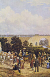
A new pub sign has appeared recently on the other side of tawdry Eversholt Street from Euston Station. This is the fringe of Somers Town, where Flinders’ last months were spent in lodgings near Fitzroy Square. His body was interred in St James’s Burying Ground, on the edge of the fields east of Regents Park. Within a quarter of a century that personage whose effigy looks down on Matthew Flinders, Robert Stephenson, had driven the first intercity railway line across those fields to a terminus in Euston Grove. As the station expanded with more platforms, it covered part of the burial ground, where tombstones were moved away. Enter HS2 and the archaeologists of a more discriminating age. The story of the careful uncovering of the lead breast plate which identified Flinders’ body hit the head-lines, here as well as in Australia. Some attention has also been given to his recent reinterment back in Donington. So, does that pub sign ‘Captain Flinders’, swinging nearby those of ‘The Rocket’ and ‘Royal George’, signal that he has finally attained, in this country, the popular accolade of a ‘Historical Hero’?

Michael Barritt RN is a historian and the author of Nelson’s Pathfinders: A Forgotten Story in the Triumph of British Sea Power.